
My Grandma Alice was born in Craigville, a small logging town north of Effie, Minnesota. Fame eluded it, fortune was in the eye of the beholder.
The one claim on the national scene comes from a photo taken in 1937 inside the town’s only tavern, “Peggy’s in Craig.” The image was used in 1982 for the opening credits of the television show “Cheers.” The last time I was there was over 60 years ago. I can vaguely remember a couple of abandoned buildings, one being “Peggy’s.”
In my youth we used to go to Craigville for two reasons. Some fishing openers we would spend below Little American Falls on the Bigfork River. The other was during deer season with my uncle along an old railroad grade called the “Holmstrum Spur.”
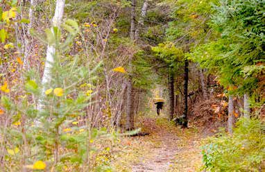
The “Spur” was connected to a logging railroad line that ran from Bemidji to International Falls. It dipped south from the main line to timber camps along the Bigfork River all the way to Craigville. The rails were picked up and the ties removed long before I hunted there. What was left was a flat gravel grade about 30 feet wide with second growth forest littered on either side laced with trails – some tramped down by deer and some the remains of old logging roads left by horse drawn drays. It stretched endlessly for miles through the wilderness. We never ventured far past where we could drive. There were thousands of acres to hunt. I don’t remember meeting other hunters back there. Some severe winters in the early ‘60s had taken its toll on the deer population, but we would occasionally get lucky and bag one.
It was an area that intimidated me. Very few landmarks were present, and I feared getting lost.
One vivid memory was in 1966 when after a moderate snowfall, we crossed the tracks of a critter that sent chills down my spine.
The prints were well-shaped and preserved in the new, wet snow.
They were round, more than six inches in diameter and bore no nail prints. I could fit my entire hand with fingers spread inside of a single paw print. No other critter but a cougar would leave something like that in northern Minnesota.
I’ve driven, biked, hiked and ridden ATV’s over many of these abandoned railways over the years. Some were obviously roadbeds, others not so much.
Most have names that refer to their original purpose. Words like spur, line and grade are giveaways. The Holmstrom Spur, The Cloquet Line, The West/ East General Grade or sometimes just “The Grade.” Others have names that are more subtle.
The “Missabe Road”, sometimes called the “Red Road” because of the iron mine tailings that were used to establish that roadbed. The “Sawbill Trail” as parts made up the route to the “Sawbill Landing” near where that logging town once existed.
There are several grades leading to and from that central area in the Superior National Forest – some still in use 30 years ago. Many turned into Forest Service roads. Some are now used as ATV trails. The “Four Mile Portage” started as a rail line from Fall Lake to Basswood. It you look at a map and see distances of road in a straight line; odds are good that the route started as a rail line.
Not all railroads were equal.
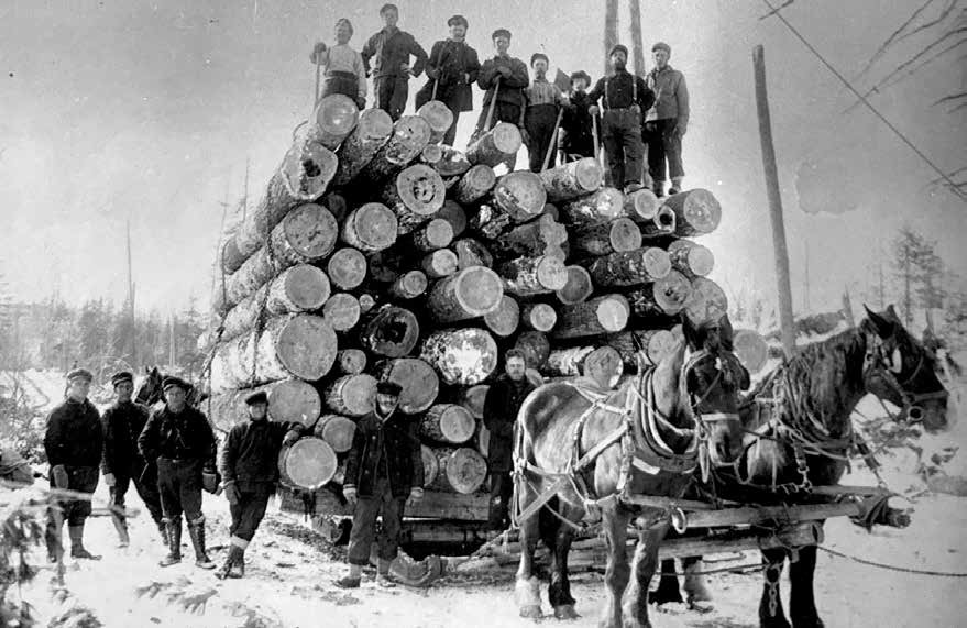
Some were standard gauge rail, and some were narrow rails.
Those that were narrow were intended specifically to be temporary. Cheaper to build and meant for only a few seasons making them practical and easy to build and then dismantle. The old logging companies like Swallow and Hopkins made scores of miles of these systems that moved timber from deep in what otherwise was known as the “Roadless Area” into what now is the BWCAW. The Cloquet Line didn’t stop at what is now the Forest Service parking lot for Mudro but went past Boot and Gun Lake with a spur that turned west and ended near the old fire tower at Angleworm Lake.
Old ties can be found between Fourtown and Moosecamp.
Another spur of the Cloquet Line turned east towards Range Lake, bordering Sandpit going behind Murphy Lake (Tin Can Mike) to Horse Lake. The portage between Sandpit and Tin Can Mike still sports some of the logs used as ties that poke up through the dirt to catch a toe on occasion.
S&H had a narrow-gauge line that went past Disappointment Lake to Thomas Lake. Some of the old trails and portages in that part of the country follow the narrow-gauge track routes of that time. Visitors to the Boundary Waters have probably portaged canoes over railroad grades and never knew it.
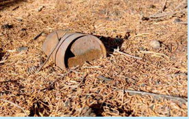
Besides the roadways themselves, often there are other remembrances left along the way. One grade near Bigfork used to provide us with spikes tossed aside when the rails were dismantled. Some of the grades south of Highway 1 have huge piles of slate, once used for stabilizing the sides of steeper slopes leading to the tops of higher hillsides. Old cables, sheets of steel and turnstiles can be found discarded well into the woods.
Ties burned in the Pagami Fire can be found near Forest Center.
Abandoned tunnels have become photo stops near the Trestle Inn, which in and of itself was built from an old railroad bridge that was dismantled. I’ve even heard tell of a wood-fired engine that was left behind when a narrow-gauge rail route was no longer needed four portages into the Boundary Waters.
Now that late fall is here and the leaves are gone, these pathways become even easier to find and more inviting to travel.
I’ve spent dozens of days and hundreds of hours along these pathways, hunting, hiking, portaging, photographing and just plain enjoying. Knowing where they come from adds to the story. Imagining the lumberjacks, train engineers, conductors and track gangs who built and maintained these railways helps me know where and why the forest is where it is now. Remembering – clear back to my youngest days – gives me perspective that the occasional or casual visitor does not have. Unfortunately, much of this history and the people who lived it have been lost to time. Unlike the theme song for the TV show “Cheers,” they are caught in a place where “nobody knows their name.”